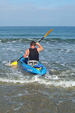
On Friday April 3rd, I flew out to my cousin Dana’s in Chapel Hill, North Carolina (near Raleigh) for a visit. One of the first things I wanted to do was to get out and paddle. Near by Chapel Hill are the rivers, The Eno, The Flat, and the Nuese. I searched for some places to rent a kayak. Found an operation called Frog Hollow. For $38 I was able to get a sit-in kayak for about three hours.
On Sunday I woke early and drove to the Eno River. It was cold when I got near to the river and steam was rising off the water. Luckily I had prepared for cool weather, although it was a nice sunny day. I arrived at the river about 8:00 am.

There was a couple getting their kayaks ready to go out. I chatted with them for a while. They had only been kayaking a few months and asked how long I had been kayaking. I told them and they asked me if I had any tips for them. I first had a question for them. "What was the longest trip they had made so far?" They told me that it was about 13 miles. I said they really did not need any tips from me. However, I did tell them that one thing I really enjoy is keeping this Kayak Blog. I gave them the address to it. Hopefully they will remember and take a look. Unfortunately by the time of this writing (two weeks later) I have forgotten their names. So if you happen to view my blog and give me your names I will post them.
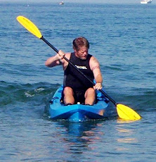
The kayak guide showed up about 0830. He briefed me on the operation of the kayak. It is a sit-in but has no rudder. So it operates very much like my ocean kayak. But he did have to instruct me on how to get out of it and empty it of water in case of a spill. Luckily, a skill I did not have to utilize. I had printed out a map of the three rivers and brought that along, as instructed. He showed me where I could go. I decided that I would go down the Eno until I got to the confluence of the Flat River. Then I would paddle up the Flat for a while, turn about and return to the Eno and then go out to the Nuese River. That leads into a lake. But I did not think I would get that far.

I started paddling. It was cool. But soon I would have to peel off all of my layers of clothing except my shirt and shorts. There was virtually no river current. And so it was impossible to tell if you were going up or down stream. This was good in that I never had to fight the flow of the river. But it later became an issue as you will see.
I had a very enjoyable cruise down the Eno to the Flat. Turned up the Flat and paddled for about
 50 minutes. I then turned about and went back to the confluence of the Flat and Eno Rivers. The guide had told me to look out for a group of power lines. This would mark the confluence of the Flat and Nuese Rivers. I found them and headed out into the Nuese. So I paddled for another 45 minutes and came out to a widening in the river. I there met a fisherman and his son. I asked them where the lake began. He pointed out a train trestle bridge that crossed the water and said that was it. It looked too far to go. So I then turned back up the Nuese to return to the Eno.
As directed I followed the power lines until they crossed. This would mark the turn into the Eno. I continued on when I found that I was paralleling the power lines instead of crossing under them. My map had disintegrated by then. And then I kept running into channels that turned out to be dead ends. There was a point where I was becoming frustrated and on the edge of worry. About this time I ran into two other kayakers. They were going up the channel I had just gone up. I told them it was a dead end. They said it did go through and continued on. I went around to find the open channel. And soon I met up with them again. I told them where I wanted to be and they said they would lead me back. When we came out it turned out that I was up in the Flat River above the confluence with the Eno River. I had gotten disorientated. I am glad I ran across the kayakers. I would have kept going up the Flat until I had reached these recognizable boat ramps on that river (where I had turned around). I was not in any real danger of being lost for good. But, going up the Flat until that boat ramp, would have delayed my return to The Eno River Boat launch. And I don’t when they would have figured me over due and sent a search party.


Question: Which of these is the through channel?
Answer: All of the above. So you can see my dilemma. None of them look to be through channels.
I eventually got safely back to my starting point and had returned on time. So I was not missed. I recommended to the guide that they make laminated maps for us tourists so we would not get lost when our map disintegrates. He said they had tried that but the maps kept disappearing. I don’t know why they have this problem. The kayak operations at La Jolla give out maps and seem to get them back. And there is very little chance of getting lost. I described my situation to the guide. He told me that because the river level was high the ground below the power lines had flooded and this made it appear to be a channel. Thus the cause of my disorientation.
So my adventure on the Three Rivers was very good. But give me the easy navigation of a clear coastline anytime.